Where there's a friend, there's a way!
Coming soon...
Wednesday, November 12, 2008
Wednesday, November 05, 2008
2008-09-02: Valparai, TN
Journey of a person from being a motor-biking maniac to a motor-biking psycho, me.
Its more than couple of months that I could finally sit down, trying to get a narration going on what happened to be a turning point in my biking aspirations. Going solo from Bangalore to Chennai, a distance of 380kms stop to stop on mostly amazing four lane highway, was to give way to something that even I would not have dreamed about a couple of years back.
The Beginning
Fifth September, Friday, happened to be the first birthday of Lipi, my youngest niece. I had got to be in Chennai for that. This meant that if I took leave from office for Thursday as well, I could take a small detour somewhere for two days (Wednesday being a holiday). There was a certain sense of uncertainty about it. Through a series of coincidences, the detour was finalized as Valparai, a small tea country about 100kms south of Coimbatore, and Eravikulam National Park, adjoining Valparai. Uncertain because it was 'planned' way in advance and as you would know by now, planned trips rarely ever worked for me. It however nearly worked out this time...
The day had been happening so far. A series of professional meetings that would have happened later in the week were held today. Those which could not, were pushed to next week. Call it destiny, I was busy answering calls till 8 o'clock the evening and was out on my way at 9.15pm.
Veerappan Territory
Earlier, googling for Valparai had me stumble upon Shriram's blog. What started off as a set of queries about Valparai quickly spurred up into an effort of finding the best possible route for Bangalore - Coimbatore stage. He was a native of Coimbatore and seemed to have a very good idea of roads around the city. In the end however, all effort came to a naught when a change in my program mandated me to take the Mysore route.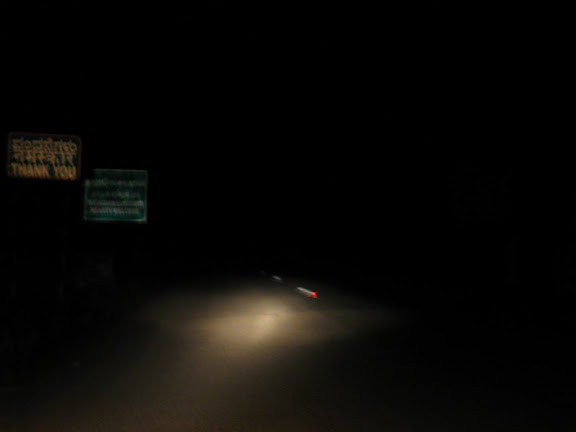 Following Kalyan's suggestion, I hit back NH-209 (Bangalore - Dindigul) at Chamrajnagar, beyond Kollegal owing to bad roads between Bangalore and Chamrajnagar. This meant that I had about 40 more kms to cover.
If it was the pounding rain before Mysore that had slowed me down, it was the very absence of road surface that was a problem post Chamrajnagar. This Veerappan (late Sandalwood mafia) territory was void of any visible human population, and apparently roads! However, as soon as I crossed over into Tamil Nadu, I could hardly believe that I was on the same road as just a while back. I simply had to come back, make a quick stop and click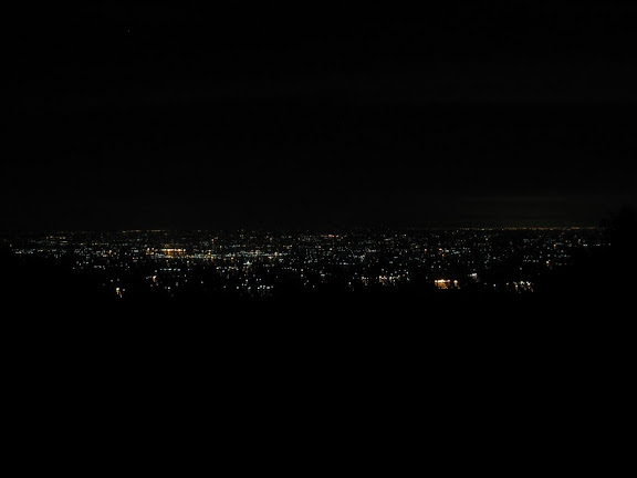 the marked difference in quality of road right at the border of two states. Only, I could not use my tripod due to lack of time (it is not advisable to stop for a long time in wild). Just before I hit Sathy (Satyamangalam), a small ghat section was encountered. It was time to take the much needed break (only two till then - Ramnagaram and Nanjungud). The view was amazing, with the lights of Sathy glittering down below and the twinkling stars studded in now clear sky.
Good Morning
A Costly Miss
It took me a while before I reached Valparai. The route till the 38th hair-pin (yes, there were in total 40 hair-pin bends in total!) was just too good, and may I say, green. As I negotiated the last few turns, the landscape dramatically transformed into a blanket of tea velvet. Now I knew as why this place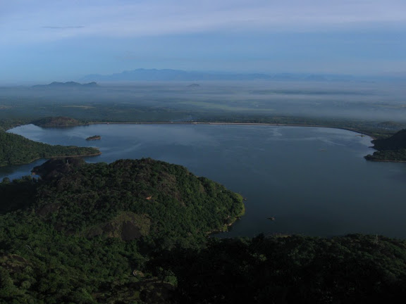 was called a tea country...
As a entered Valparai, the first thing in mind was to inquire about the entry procedure in Eravikulam and Indira Gandhi National Parks. Couple of not so good news followed. The first one, that bikes were not allowed inside NP was kind of expected, and the reason behind me dropping the idea of venturing into Eravikulam NP. The bigger blow was that I could not take entry pass for Indira Gandhi NP in Valparai; I was supposed to take it from its office around 30kms away, on the route that I'd just covered. This meant, no wild creatures in my collection, especially no Nilgiri Thar :(
Exploring Valparai
As such, there was nothing much in the town, in fact not even a choice in terms of restaurants! There was this small hotel near bus stand that needed some effort to be found. After gobbling down a Masala Dosa and an Onion Dosa, I was out agai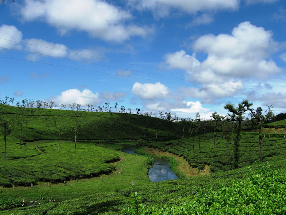 n for the next leg. It would be criminal if I don't mention the most delicious item that I had at this place, TEA :D
The target was Sholayar Dam, supposed to be the second biggest masonry dam in Asia (I think I've visited the biggest one as well, Nagarjuna Sagar Dam in Andhra Pradesh ;)). The roads were all single and though not strewed by potholes, they did not exactly present me a smooth ride. Who cared! Quite often, I would stop over,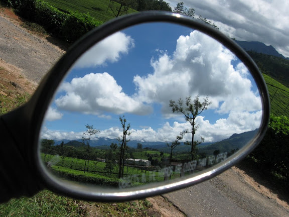 sometimes to just gaze at streams that flown by, or the landscape in general. One of the stops presented me something different. Just as I was about to start after capturing a landscape, I happened to look back in my rear view mirror. Its content was too serene to describe, so added a 1000 words to my camera's memory - a snap :)
After a while, I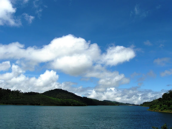 could see the back waters of Sholayar Dam, though as it turned out, the dam was still some distance away. Once I reached the Dam, I had a decision to take - whether to continue on this road for 50 more kms or take a U turn. Athirampally Falls (near Chalakudi in Kerela) waited for my third visit. I'd been there twice before with my family. After some dilemma, it was a U turn back; mind prevailing over heart. Coming back to Valparai town, it took little time to find lodging. As I had a late lunch and went back to hotel, the bright whites in sky had given way to dark looming cloud. What followed was an optimal end to my otherwise 36 hour day. For me, night started at 6pm.
The Next Day
As the morning star shown brightly through window, I lazily glanced at my cell. It was 7am and time to get up. 13 hours of sleep had done wonders to my body. One hour later, I was on my way to Nallamudi view point. My Pulsar had already done more than 550 kms since it left Bangalore; it was time for its second refill. The petrol pump lady was generous enough to warn me that I needed to constantly ask for my destination, read Nallamudi,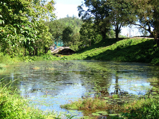 lest I wanted to loose my way and end up somewhere else. As luck would have it, I did take a wrong way briefly; not that I never asked folks on the way, rather neither of us could understand each other. The 'lost' way however was not bad either. In fact, I noticed one of those haunted movie huts, deserted out there,
 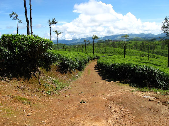 over looking a lake with a distinct over growth snuggling it in!
After covering some good and some not so good roads, I was finally there. This place was bang in the middle of a tea estate, completely hidden from outside and well camouflaged so as to send me again hunting in the wrong direction some 200 meters before it. The effort was more than worth it finally. An amazing panorama waited for me to be captured, and I readily obliged. A perfect place for a night camp.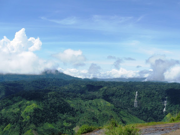 I could see a number of waterfalls, big and small cascading down on the other side of valley. It was time to relish one of nature's best servings. I just stayed there as time came to a stop; the signal going permanently red. This meant that I had little time to go beyond this place in this direction and cut down the other view point further ahead - it actually didn't matter. That is something that I would not do deliberately this time; leaving few places so that I can
 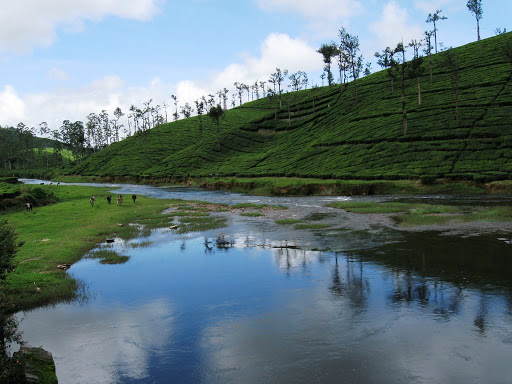 come back for second time..
I however didn't miss the serene Koolangal river that flowed by on my way back. Finally, it was time to head towards the two lesser known dams, Lower and Upper Nirar Dams. To be frank, the dams actually didn't impress me one bit, though the route was scenic. May be, this had something to do with Nallamudi... Still, something that can easily be given a miss. However, going towards Chinnakallar (little beyond Upper Nirar Dam) wasn't completely a waste.
The Down Pour
The primary idea was to visit the Chinnakallar waterfalls. I was told that Chinnakallar is the second wettest place in India, after Cherapunji in Meghalaya (not sure as I think Agumbe in namma Karnataka has overtaken Cherapunji in the past few years). As I reached what looked like a bus stop, I found a sudden dead end. There was absolutely no way out, except for a typical stone and mud way steep up the hill leading into a private estate.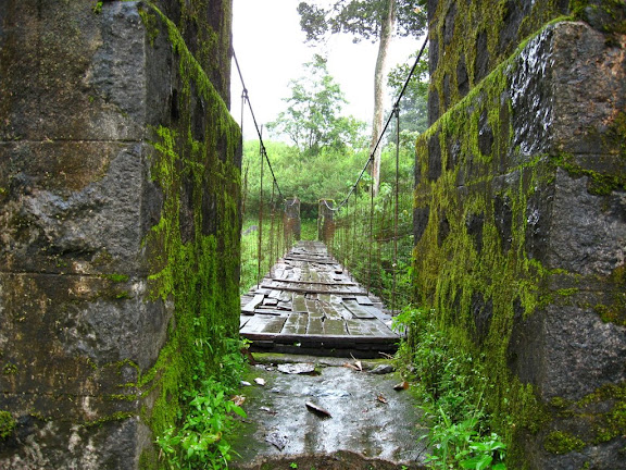 There were few huts around and I decided to finally knock the doors and ask for directions. Again, shocked! Not a single soul around! No one in the huts next to the bus stop and no one in the one up the hill. To add, a strong drizzle came on. As I saw some more huts beyond a small stream and decided to check them out as well, a gentleman crossed me from the opposite direction. He confirmed that I was indeed on right track and about 300 meters from the falls. I again confirmed the same from a person in the hut (it
 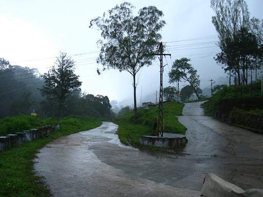 was actually a post office!). The waterfalls was also a damp squib, but the rope bridge across just provided that rustic look. As I clicked quickly to capture the location (quick so as to avoid the camera from getting wet) and headed back, the rain intensified. As if to prove a point or two, rain had really taken off in a big way. So much so that visibility had gone below 100 meters. with big dense drops falling. I had to finally take a break at a bus stop next to Upper Nirar Dam to get into my proper rain gear. I found the same gentleman, whom I had met near Chinnakallar PO. He was waiting there along with few of his acquaintances for the rain to stop. He asked me about my whereabouts and as usual, there were few eyeballs ready to jump out of eye sockets ;)
Return Gift
As I bid them good bye and proceeded little further, I was caught by surprise. This was not a goat, but the Nilgiri Thar on the steep slope about 10 meters from me! Not sure if they are maniacs about clinging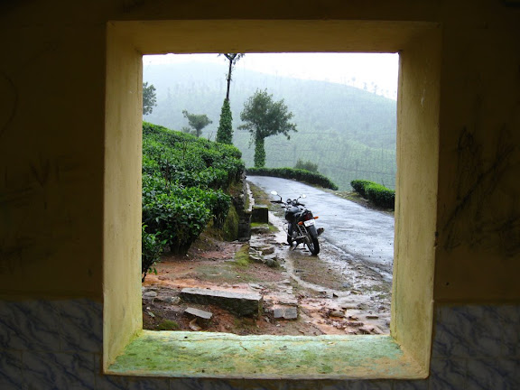 to such gradients and not feeding on the same green grass available on plain land 20 meters away! The only glitch was that I could not shoot this guy; it was raining just to heavily for the camera to be taken out. I was starting to get hungry as I rode back towards Valparai. Little beyond a right turn that I took towards Balaji Temple (you can avoid circling through Valparai; this is a good shortcut), I found an empty bus stop (lot of bus stops this area and very decent public transport). I had few left over moffins (that I was carrying from
 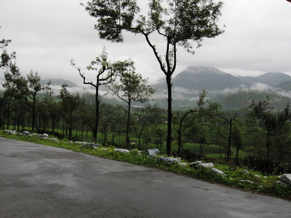 Bangalore as 'sankat mochan' or life saver) that was happy to gobble'em up as what turned into my luncheon. Couple of villagers got down from a bus, looked at me having my 'lunch', gave queer looks, and left. Not the rain; it was persistent. This meant that the very purpose of me taking turn towards Balaji's temple got defeated. The temple was already closed for the day (it closes down at 12:30pm as I was informed in Valparai). Continuous rain meant that my camera remained indoors. Finally, I decided to give the renowned 'Tunnel View', not far from temple and the motive behind taking the turn, a pass. "There's always a next time".
Down the Ghats
2:10pm. As you'd have it, the rain stopped as soon as I left Valparai behind. No looking back, it was time to move on. The ghats ahead provided a much different view. Now, I could associate meaning to the warning boards that I'd seen while coming up, "Caution, Mist Zone". There was this lazy aura that surrounded the area.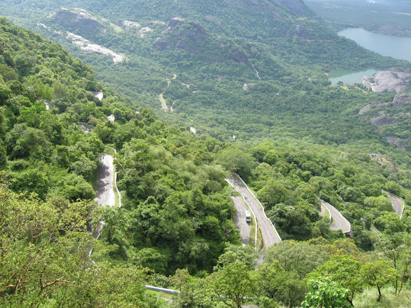 There I was, cutting right through this living dream, into the hair pin bends down the hill. As I descended down, I could see the very 9th hair-pin turn where I'd stopped over while coming up. It was too good for me to give a pass. Twelfth hair-pin was where I stopped finally, to take a break and get my camera out of its box. As it turned out, this was the last time it was out for that day; Once I reached Monkey Falls (it is right at the beginning of the ghats, not far from the check-post while coming up), I was surprised to see the amount of water that flowed in. I had given it a pass due to lack of water a day before and here I was - a bit too much in terms of spray and yet again it screamed out,
 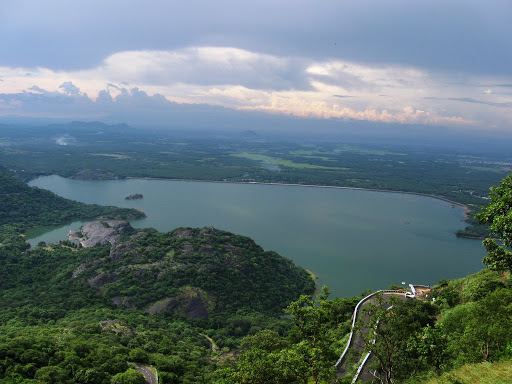 "For your eyes only!" Incidentally, I met the same policeman manning the check-post. He could immediately recognize me. "How was Valparai? Wasn't it good! On your way to Chennai now? Be careful, its more than 600 kms from here. Where are you taking night halt, take it in Salem....." Lots of enthusiasm and lots of concern, something missing in a 'general' policeman these days... I convinced him that I'll drive safe, and was off to ...Chennai, via Coimbatore -> Salem -> Chinna Salem -> Villupuram -> Pondicherry -> Mahabalipuram route.
The Last Leg
Little more than 100 kms from Valparai, I took my first tea break. What came back alive was my Airtel cell phone; Valparai only has BSNL (GSM) and Reliance (CDMA) cell phone towers, so any Airtel guy can rest assure that he'll not be disturbed (even if he wants) by a ringing cell phone in Valparai. It was time to update my family about my where abouts, something that has now become customary during nearly all pit stops of a solo riding journey. The road till Salem was expected to be 'not so good', as the four laning work is going on currently. I was really looking forward to reaching Salem, and enjoy the two lane driving. Weel, as it turned out, it was not the case - that route, till Chennai was also in faor laning process :(
As soon as I hit Villupuram little beyond 3am, I was more than happy to take a deviation towards right. A sign said, "Pondicherry, 38kms". That was some relief, no more traffic and more important of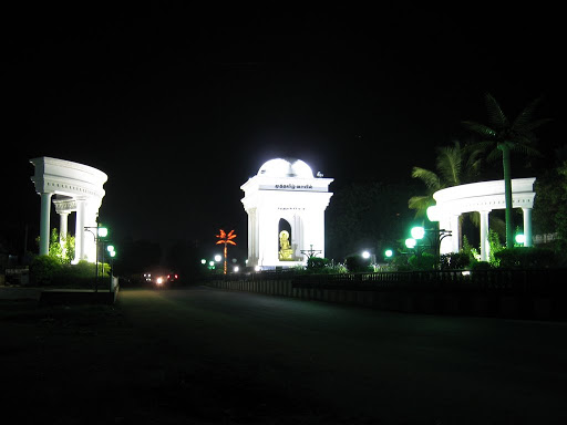 all, no dust bowls! 30 minutes later, I found myself near the Gandhi statue on Pondy's Marine Drive. As I soaked in a typical humid air, I just wondered - only a fortnight back, on my family trip from Chennai to Pondy, I'd uttered, "East Coast Road (ECR) is something, some day, I'll love to be on it, on my bike...". I was also in time for a sun rise in Mamlapuram, errr... Mahabalipuram! But as it turned out, I was there a bit too early.
 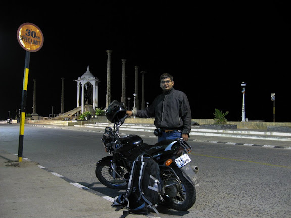 One hour wait was just too much. 143 kms, till my sister's place near Medavakkam from Pondy sea front, done just under 100 minutes, not to forget two 5 minute breaks - two lane highway driving at its best. I was knocking at my sister's place just as I turned my headlights off, at 5 to 6. It was Lipi's (sister's kid) B'day and her Mama was on time :D
When I reached Bangalore back after spending couple of days in Chennai, my odometer read 647 kms, presenting a poker face for its limitation to get reset to 000 kms after 999.9! Rest of the photos can be found here.
Its more than couple of months that I could finally sit down, trying to get a narration going on what happened to be a turning point in my biking aspirations. Going solo from Bangalore to Chennai, a distance of 380kms stop to stop on mostly amazing four lane highway, was to give way to something that even I would not have dreamed about a couple of years back.
The Beginning
Fifth September, Friday, happened to be the first birthday of Lipi, my youngest niece. I had got to be in Chennai for that. This meant that if I took leave from office for Thursday as well, I could take a small detour somewhere for two days (Wednesday being a holiday). There was a certain sense of uncertainty about it. Through a series of coincidences, the detour was finalized as Valparai, a small tea country about 100kms south of Coimbatore, and Eravikulam National Park, adjoining Valparai. Uncertain because it was 'planned' way in advance and as you would know by now, planned trips rarely ever worked for me. It however nearly worked out this time...
The day had been happening so far. A series of professional meetings that would have happened later in the week were held today. Those which could not, were pushed to next week. Call it destiny, I was busy answering calls till 8 o'clock the evening and was out on my way at 9.15pm.
Veerappan Territory
Earlier, googling for Valparai had me stumble upon Shriram's blog. What started off as a set of queries about Valparai quickly spurred up into an effort of finding the best possible route for Bangalore - Coimbatore stage. He was a native of Coimbatore and seemed to have a very good idea of roads around the city. In the end however, all effort came to a naught when a change in my program mandated me to take the Mysore route.
Following Kalyan's suggestion, I hit back NH-209 (Bangalore - Dindigul) at Chamrajnagar, beyond Kollegal owing to bad roads between Bangalore and Chamrajnagar. This meant that I had about 40 more kms to cover.If it was the pounding rain before Mysore that had slowed me down, it was the very absence of road surface that was a problem post Chamrajnagar. This Veerappan (late Sandalwood mafia) territory was void of any visible human population, and apparently roads! However, as soon as I crossed over into Tamil Nadu, I could hardly believe that I was on the same road as just a while back. I simply had to come back, make a quick stop and click
the marked difference in quality of road right at the border of two states. Only, I could not use my tripod due to lack of time (it is not advisable to stop for a long time in wild). Just before I hit Sathy (Satyamangalam), a small ghat section was encountered. It was time to take the much needed break (only two till then - Ramnagaram and Nanjungud). The view was amazing, with the lights of Sathy glittering down below and the twinkling stars studded in now clear sky.Good Morning
The first rays of Sun hit me little beyond Coimbatore, a while after I crossed NH-47 (Salem - Kochi - Kanyakumari). Road had been good so far (after entering TN) and 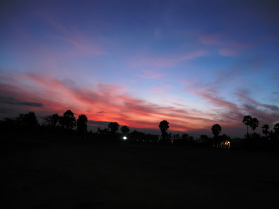 things didn't change once I took the deviation in Pollachi, towards Valparai. Just as a mile stone indicated that Valparai was 42kms away, I noticed a billboard depicting the Nilgiri Thar, an avid cliff loiterer and TN's state animal. A break here, and I was away again to be stopped a few kms down, just beyond the Aliyar Dam, at a check-post by a friendly officer. What came next was the most enchanting view of plains and Aliyar Dam down below.
things didn't change once I took the deviation in Pollachi, towards Valparai. Just as a mile stone indicated that Valparai was 42kms away, I noticed a billboard depicting the Nilgiri Thar, an avid cliff loiterer and TN's state animal. A break here, and I was away again to be stopped a few kms down, just beyond the Aliyar Dam, at a check-post by a friendly officer. What came next was the most enchanting view of plains and Aliyar Dam down below.A Costly Miss
It took me a while before I reached Valparai. The route till the 38th hair-pin (yes, there were in total 40 hair-pin bends in total!) was just too good, and may I say, green. As I negotiated the last few turns, the landscape dramatically transformed into a blanket of tea velvet. Now I knew as why this place
was called a tea country...As a entered Valparai, the first thing in mind was to inquire about the entry procedure in Eravikulam and Indira Gandhi National Parks. Couple of not so good news followed. The first one, that bikes were not allowed inside NP was kind of expected, and the reason behind me dropping the idea of venturing into Eravikulam NP. The bigger blow was that I could not take entry pass for Indira Gandhi NP in Valparai; I was supposed to take it from its office around 30kms away, on the route that I'd just covered. This meant, no wild creatures in my collection, especially no Nilgiri Thar :(
Exploring Valparai
As such, there was nothing much in the town, in fact not even a choice in terms of restaurants! There was this small hotel near bus stand that needed some effort to be found. After gobbling down a Masala Dosa and an Onion Dosa, I was out agai
n for the next leg. It would be criminal if I don't mention the most delicious item that I had at this place, TEA :DThe target was Sholayar Dam, supposed to be the second biggest masonry dam in Asia (I think I've visited the biggest one as well, Nagarjuna Sagar Dam in Andhra Pradesh ;)). The roads were all single and though not strewed by potholes, they did not exactly present me a smooth ride. Who cared! Quite often, I would stop over,
sometimes to just gaze at streams that flown by, or the landscape in general. One of the stops presented me something different. Just as I was about to start after capturing a landscape, I happened to look back in my rear view mirror. Its content was too serene to describe, so added a 1000 words to my camera's memory - a snap :)After a while, I
could see the back waters of Sholayar Dam, though as it turned out, the dam was still some distance away. Once I reached the Dam, I had a decision to take - whether to continue on this road for 50 more kms or take a U turn. Athirampally Falls (near Chalakudi in Kerela) waited for my third visit. I'd been there twice before with my family. After some dilemma, it was a U turn back; mind prevailing over heart. Coming back to Valparai town, it took little time to find lodging. As I had a late lunch and went back to hotel, the bright whites in sky had given way to dark looming cloud. What followed was an optimal end to my otherwise 36 hour day. For me, night started at 6pm.The Next Day
As the morning star shown brightly through window, I lazily glanced at my cell. It was 7am and time to get up. 13 hours of sleep had done wonders to my body. One hour later, I was on my way to Nallamudi view point. My Pulsar had already done more than 550 kms since it left Bangalore; it was time for its second refill. The petrol pump lady was generous enough to warn me that I needed to constantly ask for my destination, read Nallamudi,
lest I wanted to loose my way and end up somewhere else. As luck would have it, I did take a wrong way briefly; not that I never asked folks on the way, rather neither of us could understand each other. The 'lost' way however was not bad either. In fact, I noticed one of those haunted movie huts, deserted out there, over looking a lake with a distinct over growth snuggling it in!After covering some good and some not so good roads, I was finally there. This place was bang in the middle of a tea estate, completely hidden from outside and well camouflaged so as to send me again hunting in the wrong direction some 200 meters before it. The effort was more than worth it finally. An amazing panorama waited for me to be captured, and I readily obliged. A perfect place for a night camp.
I could see a number of waterfalls, big and small cascading down on the other side of valley. It was time to relish one of nature's best servings. I just stayed there as time came to a stop; the signal going permanently red. This meant that I had little time to go beyond this place in this direction and cut down the other view point further ahead - it actually didn't matter. That is something that I would not do deliberately this time; leaving few places so that I can come back for second time..I however didn't miss the serene Koolangal river that flowed by on my way back. Finally, it was time to head towards the two lesser known dams, Lower and Upper Nirar Dams. To be frank, the dams actually didn't impress me one bit, though the route was scenic. May be, this had something to do with Nallamudi... Still, something that can easily be given a miss. However, going towards Chinnakallar (little beyond Upper Nirar Dam) wasn't completely a waste.
The Down Pour
The primary idea was to visit the Chinnakallar waterfalls. I was told that Chinnakallar is the second wettest place in India, after Cherapunji in Meghalaya (not sure as I think Agumbe in namma Karnataka has overtaken Cherapunji in the past few years). As I reached what looked like a bus stop, I found a sudden dead end. There was absolutely no way out, except for a typical stone and mud way steep up the hill leading into a private estate.
There were few huts around and I decided to finally knock the doors and ask for directions. Again, shocked! Not a single soul around! No one in the huts next to the bus stop and no one in the one up the hill. To add, a strong drizzle came on. As I saw some more huts beyond a small stream and decided to check them out as well, a gentleman crossed me from the opposite direction. He confirmed that I was indeed on right track and about 300 meters from the falls. I again confirmed the same from a person in the hut (it was actually a post office!). The waterfalls was also a damp squib, but the rope bridge across just provided that rustic look. As I clicked quickly to capture the location (quick so as to avoid the camera from getting wet) and headed back, the rain intensified. As if to prove a point or two, rain had really taken off in a big way. So much so that visibility had gone below 100 meters. with big dense drops falling. I had to finally take a break at a bus stop next to Upper Nirar Dam to get into my proper rain gear. I found the same gentleman, whom I had met near Chinnakallar PO. He was waiting there along with few of his acquaintances for the rain to stop. He asked me about my whereabouts and as usual, there were few eyeballs ready to jump out of eye sockets ;)Return Gift
As I bid them good bye and proceeded little further, I was caught by surprise. This was not a goat, but the Nilgiri Thar on the steep slope about 10 meters from me! Not sure if they are maniacs about clinging
to such gradients and not feeding on the same green grass available on plain land 20 meters away! The only glitch was that I could not shoot this guy; it was raining just to heavily for the camera to be taken out. I was starting to get hungry as I rode back towards Valparai. Little beyond a right turn that I took towards Balaji Temple (you can avoid circling through Valparai; this is a good shortcut), I found an empty bus stop (lot of bus stops this area and very decent public transport). I had few left over moffins (that I was carrying from Bangalore as 'sankat mochan' or life saver) that was happy to gobble'em up as what turned into my luncheon. Couple of villagers got down from a bus, looked at me having my 'lunch', gave queer looks, and left. Not the rain; it was persistent. This meant that the very purpose of me taking turn towards Balaji's temple got defeated. The temple was already closed for the day (it closes down at 12:30pm as I was informed in Valparai). Continuous rain meant that my camera remained indoors. Finally, I decided to give the renowned 'Tunnel View', not far from temple and the motive behind taking the turn, a pass. "There's always a next time".Down the Ghats
2:10pm. As you'd have it, the rain stopped as soon as I left Valparai behind. No looking back, it was time to move on. The ghats ahead provided a much different view. Now, I could associate meaning to the warning boards that I'd seen while coming up, "Caution, Mist Zone". There was this lazy aura that surrounded the area.
There I was, cutting right through this living dream, into the hair pin bends down the hill. As I descended down, I could see the very 9th hair-pin turn where I'd stopped over while coming up. It was too good for me to give a pass. Twelfth hair-pin was where I stopped finally, to take a break and get my camera out of its box. As it turned out, this was the last time it was out for that day; Once I reached Monkey Falls (it is right at the beginning of the ghats, not far from the check-post while coming up), I was surprised to see the amount of water that flowed in. I had given it a pass due to lack of water a day before and here I was - a bit too much in terms of spray and yet again it screamed out, "For your eyes only!" Incidentally, I met the same policeman manning the check-post. He could immediately recognize me. "How was Valparai? Wasn't it good! On your way to Chennai now? Be careful, its more than 600 kms from here. Where are you taking night halt, take it in Salem....." Lots of enthusiasm and lots of concern, something missing in a 'general' policeman these days... I convinced him that I'll drive safe, and was off to ...Chennai, via Coimbatore -> Salem -> Chinna Salem -> Villupuram -> Pondicherry -> Mahabalipuram route. The Last Leg
Little more than 100 kms from Valparai, I took my first tea break. What came back alive was my Airtel cell phone; Valparai only has BSNL (GSM) and Reliance (CDMA) cell phone towers, so any Airtel guy can rest assure that he'll not be disturbed (even if he wants) by a ringing cell phone in Valparai. It was time to update my family about my where abouts, something that has now become customary during nearly all pit stops of a solo riding journey. The road till Salem was expected to be 'not so good', as the four laning work is going on currently. I was really looking forward to reaching Salem, and enjoy the two lane driving. Weel, as it turned out, it was not the case - that route, till Chennai was also in faor laning process :(
As soon as I hit Villupuram little beyond 3am, I was more than happy to take a deviation towards right. A sign said, "Pondicherry, 38kms". That was some relief, no more traffic and more important of
all, no dust bowls! 30 minutes later, I found myself near the Gandhi statue on Pondy's Marine Drive. As I soaked in a typical humid air, I just wondered - only a fortnight back, on my family trip from Chennai to Pondy, I'd uttered, "East Coast Road (ECR) is something, some day, I'll love to be on it, on my bike...". I was also in time for a sun rise in Mamlapuram, errr... Mahabalipuram! But as it turned out, I was there a bit too early. One hour wait was just too much. 143 kms, till my sister's place near Medavakkam from Pondy sea front, done just under 100 minutes, not to forget two 5 minute breaks - two lane highway driving at its best. I was knocking at my sister's place just as I turned my headlights off, at 5 to 6. It was Lipi's (sister's kid) B'day and her Mama was on time :DWhen I reached Bangalore back after spending couple of days in Chennai, my odometer read 647 kms, presenting a poker face for its limitation to get reset to 000 kms after 999.9! Rest of the photos can be found here.
Saturday, April 12, 2008
2008-04-06: Yercaud, TN
All my plans for a good drive over the long weekend (celebrating Kannada New Year, ‘Ugadi’, on road, as I did for New Year 2005 – 06) had gone to the cleaners. I could count a few reasons on fingers…
- I had some pending task for Saturday, so could have no way left on Friday night.
- None of my two partners in crime, Abdulla (office commitments) or Azmi (@home, in
“मेरा एराविकुलम नही तो
(“I was thinking of visiting Eravikulam (near Munnar, Kerela) or
(“Then why didn’t you go big brother?”)
“उम्म… एराविकुलम के लिए समय नही है, 500km पड़ेगा लगभग एक तरफ़ से| शायद बेलम गुफा जा सकते हैं, क्या बोलता है? या फिर येरकौड़, आज़मी का मन पसंद?”
(“Umm… don’t have time for Eravikulam, it's about 500kms one way. May be
“तब येरकौड चलते हैं, लेकिन पता चलने पर आज़मी भैया बहुत मारेंगे..!”
(“Ok, let’s go to Yercaud, but Azmi will hit us when he comes to know about it..!”)
And true it was. Yercaud had been in the wish list of Azmi for a long time. Most of our recent trips had started with a mention of Yercaud but canceled each time as it would not qualify for it's proximity to
The Start
We could not start before 1AM as Gaurav had to go back to his place to collect his jacket and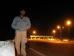 other necessary stuff. As we crossed Electronic City, my bike's fuel tank went into reserve. As planned, we made our first stop in Hosur, to take full advantage of cheaper fuel (Petrol is ~ Rs2 less in Tamil Nadu). It was also time to change guard. Though this was not the first time that Gaurav had come on a night drive (we had earlier taken up Chamundi Hills, overlooking Mysore), he was yet to drive at night.
  The 4 laned NH-7 from Hosur till Krishnagiri presented a nice platform for his maiden drive. His lack of experience clearly showed initially, but then, he took my preaching rather seriously and made me feel more comfortable by the time we reached the toll gate before Krishnagiri - a distance of 52kms done in 45 minutes, not bad!
Inter'cop'tions
We took a couple of tea breaks in between Krishnagiri and Dharmapuri. As if turned out, this was the worst stretch of road for the entire journey (not to forget the little 'under development' stretch little later, after descending the ghats and before Salem). It was around midway to Dharmapuri when we were stopped by cops of a local police station. There were four of them, all drunk till brim and maybe beyond. It was an achievement that they were still moving around (may be 'coz of practice!!) One of them straight away came asking for 'original' RC book. Curse his bad luck, I always make a point to carry the same on all my trips. The next line was as blunt as one could ever get - 'Give us money if you want to continue, else we detain you for being decoits..!' I thought this happened only in AP (I had faced a similar situation at AP-Karnataka border while returning from Tirupati).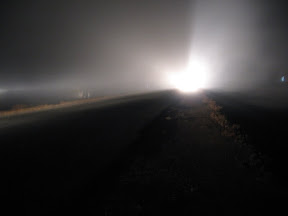 And people say that folks from Bihar are corrupt! After a long dialogs, we somehow got ourselves free from their clutches, and moved forward! The journey till Salem would have been rather eventless but for the cloud cover that suddenly engulfed us just before the little ghat section before Salem. The visibility got reduced to less than 100m making our drive little more than a crawl. No one was complaining though, for the camera came out to capture the dense white blanket...
The Climb
As we took the way up the hills, leaving Salem behind, we could see a typical scene. No, I'm not talking about the scenic mines (yes, mines can be scenic sometimes!) and the city itself or for that matter, the Sun rising behind the rocks. It was rather to do with the localites who had turned up in huge numbers just to walk/jog up and down the road leading to Yercaud. On further observation, we noticed that there were lots of monkeys too, but only till the small temple around 5kms from base of climb. As we continued beyond the temple, we encountered the second of twenty hair-pin bends to Yercaud. This came after relatively long time; the first had come just at the base of hill. As we negotiated the fifteenth turn,
  we entered coffee territory. All the while, we kept our eyes on what looked like a view point of some kind (we later learnt that this was the 'Lady's Seat'). In total, it took us around an hour's time to reach Yercaud from Salem. Our camera battery had run out (yes, I could not charge them in time :() by the time we reached the lake area, the center of town. The little shopping extravaganza that followed meant that we were fully equipped for the next leg of trip, geared up with all amenities - from mineral water and toothpaste to a pair of Duracell batteries! Well something else too, information on places of interest and visit for this trip ;)
Pagoda Point (Gent's Seat)
As we reached Pagoda Point, a pleasant surprise was awaiting us. Benefits of keeping expectations low had paid rich dividends. This place was just spectacular!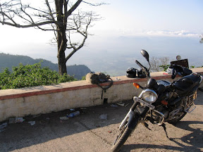 With the morning sun shining on silken cloud, we could see the pagoda shaped hills in distance - reason behind the name of this view point. We took our time to get freshened up and make ourselves a bit more presentable to camera (the night drive was otherwise having its effect felt). Once out of box, the camera just never went back till we were here. In the process, we also met a small group of people. It was a privilege to shoot them in one frame; they were meeting after a gap of more than 25 years..!
Lady's Seat
After a filling breakfast comprising Onion Dosa and tea, we set of towards the other side of this hill station, Lady's Seat. The weather was on our side. We could see the entire city of Salem from here,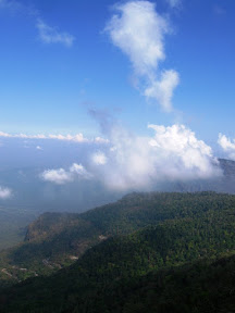 not to forget the hair-pin road that we took to reach Yercaud. It was time to sit back and soak ourselves in nature's bout - one between the hills standing tall and clouds rising above them for conquer. We found this place conducive to making calls (alas we had some cell phone signal at a view point) and made full use of it. While Gaurav fixed up a lunch appointment with Rashmi (his cousin) in Salem, I took liberty of updating my parents of my exact coordinates. All good things come to an end and so did our stay at this place.., as we turned back and headed towards the tallest view point of all around Yercaud...
Servarayan Temple and View Point
After putting the first gear briefly, we reached this place, and greeted by a guy collecting 'development fee' of five bucks per motorcycle.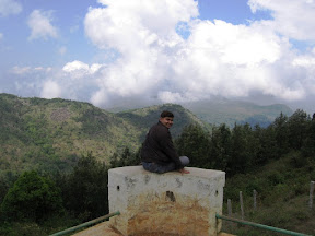 That way, it was the only place were we paid any kind of entry fee. The cave temple was out of bounds, thanks to some homa happening there. We were not complaining. This place confirmed the small piece of information that we got at the beginning of the day - each of the view points in Yercaud present completely different set of pictures. Some more clicks in the camera and we had to turn back; the sky was not exactly looking safe with dark clouds hovering, threatening us of heavy rain on our way back to Bangalore.
Kiliyur Water Falls
We were on our way back when suddenly Gaurav shouted, "Bro, there's a waterfall that way..!" Confirming the presence of some water in falls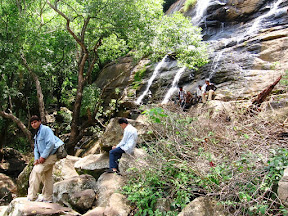 with a corn vendor besides the town lake (not to forget, bargaining a couple of baked corns for ourselves), we did a 'U' turn and took the road towards Kiliyur Waterfalls. Its around 3.5kms from the lake and one needs to park his vehicle about half a km before the falls. Then, there's a descent of about 300m. One needs to be careful on
 this slippery trail, barbed fencing at few places not helping the cause. Water was a bit less to our liking, not matching the effort we'd put in reaching this place. The view of valley from here was however another good one, not to forget, unique. Once back up, it was time to finally bid Yercaud goodbye. The delay of an hour was updated to Rashmi and off we went, rolling down the hill, taking couple of breaks to capture the last glimpses of 'Poor Man's Ooty' - a misnomer according to me!
Way Back
We were back in Salem by 1PM. After a bit of confusion for HP petrol pump at the end of 'Five Road' (for those who don't know, there is an HP petrol pump at either end of Five Road in Salem), we finally got hold of Rashmi. 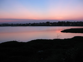 A satisfying lunch followed the rendezvous. Around couple of hours later, we were trying our level best to beat the heat with gulps of Coke and Pepsi, 50kms on the way back towards Bangalore. Fatigue and dust not withstanding, Gaurav drove for most of the stretch, barring about 40kms, till Hosur. As we switched the driving seat, the sun set over this lake on the periphery of city. 7:30PM and we were back in Bangalore, covering a total of 497 to be precise... It was time to slip into our swimming trunks and hit the pool for the the next hour and half, relax and reflect on the trip... Snapshots of the trip can be found here.
Sunday, March 09, 2008
2008-03-08: Dodda Betta, TN
This one is coming after painfully long time. I was shocked to see that the last time I had put up an entry on this blog was on 5th of August last year. This made me sit back and think of about what had gone 'wrong'. There were few observations:
Copy 'n' Paste Start
The start to this episode was identical to that of Malnad Trip. It all started of with a chain of mail until I was at Azmi's place. With Nandi Hills out of contention and Gopalaswami Betta being recently graced by Azmi, the options were limited. Either visit my Sis in Chennai, or pay tribute to a place that was yet to be analyzed in detail. 12:15AM and we had finally zeroed upon the tallest of all peaks within Deccan Platatue - Dodda Betta.
Fighting the Biting Cold!
12:30AM and we were on our way. The month of March had given us enough confidence in our jackets to pull through the night comfortably. This was probably the single biggest pothole that we overlooked! Even before we could hit Mysore Road, truth dawned in the middle of night - we were up against some seriously low temperatures and jaw rattling chill.
As the two of us took turns with control of Azmi's relatively new Pulsar150 DTSI (compared to my antique 1st Gen 'original' P150), lookout for chaiwalas continued. There was another problem that didn't help much- the new Pulsar's dreaded head-light beam (As much as I adore Bajaj for improving upon other features like shock absorbers, I detest them for making a mockery of a stupendous head light, giving way to all looks and no performance!). It was adjusted for solo riding, and now with a pillion on, we had no way to adjust the beam, save count the leaves of trees on either side of road! The first thing I was supposed to do after getting back was to find out the feasibility of beam adjustment... (I later found that its there on the right lower side, you need a long screw driver to reach it for the first time). After the customary photo shoot at Mysore Palace, we moved on towards Gundalpet...
Good Morning Bandipur
After spending about 45 minutes at a dhaba in Gundalpet, it was around 6AM that we closed upon Bandipur National Park. As morning sun greeted us, we snaked around the pot holes as Gopalaswami Betta disappeared on our right side. As we entered BNP, there was more wild life in store for me than in my earlier dedicated trip to the NP. I was however not knowing that the return journey would be even better.
Negotiating the 36 Hair-Pin Bends
As we crossed the Karnataka state border into Mudumalai NP, we were greeted at the check post. Result – we went ahead poorer by 10 bucks! Around 5-6 kms ahead was the main Mudumalai Jn where the road forks into two- taking right will take one to Gadalur. We went the other way, towards Kalahatti Ghats. This route is shorter (and better in terms of surface quality) than the former route by almost 38kms, more than 100% (Ooty is 74kms via Gudalur and 36kms via Kalahatti). The first 15kms after taking left were similar to the road in Bandipur, with the road meandering through the forest. If it were my first drive on this stretch, I would have wondered about when the actual accent would start; Ooty is around 2000 meters above in terms of altitude compared to the base of Kalahatti Ghat. This probably tells you something about the gradient that was to follow. Azmi was already getting a bit impatient when the climb finally begun.
 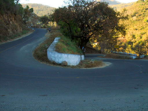 I was fully aware that this was his first ‘drive through the night’ trip on a bike and that he was really weary at this point of time. We had hardly negotiated the first few of the 36 hair-pin bends that we fund a culvert. He literally jumped off the bike to occupy one of the sides as I pulled up. A clean flat surface with the sun showing down brightly was way to luring to be missed! We took another break at the 20th hair-pin, for which the air-cooled engine of our bike was more than happy. As we neared Ooty, the climb had become so steep that I had to put the first gear as frequently as 5th on leveled ground. 12.5BHP of power was proving just adequate enough to pull our frames through!
Finally, Ooty
Rendezvous with the Baap of all Bettas
As I took the pillion seat, I tried to make full use of it. The camera went clicking and clicking; a lot of good snaps would have come, but for the bad roads to end them all as shaky as ever :(. Unlike the last time I’d driven down to Ooty and seen only fog and cloud at view-points, this was quite different. Clear blue skies and light hew greeted as we climbed further towards the tallest peak in
 South India – Dodda Betta. The name has always brought the same question in mind – how come one of the most prominent features in Tamil Nadu, a state sometimes known for fundamental linguistics, was christened in Kanadda – perhaps a true example of united
 India
On the way to Coonoor
As we descended the roads from Dodda Betta and took turn towards Coonoor, the sight was not exactly soothing to eyes, nor feelings welcomed by my bottom! The tar suddenly gave way to mud and slush; boulders filled up the rest, all together, pretty painful. Thankfully, this road condition didn't last long and after a couple of kms, we found ourselves on good roads. As the road meandered down towards Coonoor, I was on constant look out for the Toy Train that I'd taken for this journey the last time that I was in this region. Though the whistle could be heard once, the train continued to elude me. It was only when we were nearing Aruvankadu, I realized my mistake - all the while I was trying to find the train down in the valley, while it was running parallel to us on the other side, about half a km up the valley slope. As we approached Aruvankadu, the tummy started roaring louder than the bike; it was time to stop.
Saapadam @ Aruvankadu
The least we talk about the food, the better! It was one of the most ordinary chicken biryani that I ever had.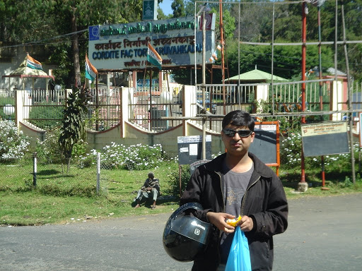 Add to that an 'extra helpful' man who was in a state of his own and a bit of bother!! All in all, a very forgettable experience :( It was time to turn back, and give Coonoor a miss for the time being - hoping that visiting this place would be an independent trip by itself.
Climbing down Kalahatti Ghats
As we hit Ooty back on our way, it really helped to go back to our breakfast hotel and help ourselves with a cup of tea.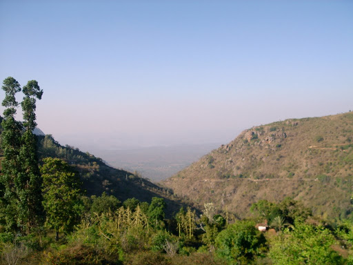 Also, there was boiled corn in offering on the other side of road. It was time that I took back the controls; not that Azmi could not drive down, it was the weight that needed to be handled while breaking on the way down hill. And some down hill it was - the engine roared in second gear almost all the time - breaks only being used intermittently to kill momentum. Still, the section was too good an experience to be missed. Azmi finally tried his hand after around three quarters of the ghats, and drove all the way till we hit the 'plains'.
Parting Show
As we stopped over at Mudumalai for tea and snacks break, we came across this all excited man who spoke very fast Tamil. All I could recognize out of speech was 'yana'.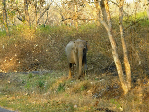 Azmi was a bit puzzled - he couldn't make head or tail of the lines spoken. "What is he talking about?" "He says that few elephants were sighted a few kms away." Probably the next thing both of us were thinking was only if we could get that lucky... (In my last dedicated trip to Bandipur, all I could find were deer, peacocks and wild buffalo) As we continued further, the gift (or rather gifts) was awaiting us - we came across 3 of them, and one was a tusker!
Juicy Gundalpet
As our bottoms hit the rock (read road in between Bandipur and Gundalpet), the juice shop in Gundalpet was what we were really looking forward to. This was Azmi's discovery on his way to Calicut. It's opposite to the KSRTC bus stand, in the basement of hotel Udupi Uphar (IIRC). Boy, this place rocked! The Fresh Lime with Soda gave Anand's (near PESIT, Bangalore) some competition :) The next proper stop came only beyond Maddur. Shivalli, a restaurant next to Cafe Coffee Day, did not live up to its hype - may be it was end of business for them, but I found wanting... Still it did give my eyes some relief from those dreaded sand laden trucks. It was around 11:30 by the time we were close to our places. Once at Azmi's place, it was time to pick my stuff and my bike back. In exactly 24 hours, I was preparing to hit the sack, happy and satisfied to break my 6 month 'break'. As I was to find out later, this gave way to the first ever solo trip that I made on my bike, more than 5 years since I took Pulsar to road, to Chennai...
- I had missed an entry for the car trip to Jog Falls (with Azmi, Gabbar and Ticklu)
- I had not gone anywhere else after that and hence no new posts.
- I was a bit too occupied to even come back and check my Travelogue!
Copy 'n' Paste Start
The start to this episode was identical to that of Malnad Trip. It all started of with a chain of mail until I was at Azmi's place. With Nandi Hills out of contention and Gopalaswami Betta being recently graced by Azmi, the options were limited. Either visit my Sis in Chennai, or pay tribute to a place that was yet to be analyzed in detail. 12:15AM and we had finally zeroed upon the tallest of all peaks within Deccan Platatue - Dodda Betta.
Fighting the Biting Cold!
12:30AM and we were on our way. The month of March had given us enough confidence in our jackets to pull through the night comfortably. This was probably the single biggest pothole that we overlooked! Even before we could hit Mysore Road, truth dawned in the middle of night - we were up against some seriously low temperatures and jaw rattling chill.
As the two of us took turns with control of Azmi's relatively new Pulsar150 DTSI (compared to my antique 1st Gen 'original' P150), lookout for chaiwalas continued.
There was another problem that didn't help much- the new Pulsar's dreaded head-light beam (As much as I adore Bajaj for improving upon other features like shock absorbers, I detest them for making a mockery of a stupendous head light, giving way to all looks and no performance!). It was adjusted for solo riding, and now with a pillion on, we had no way to adjust the beam, save count the leaves of trees on either side of road! The first thing I was supposed to do after getting back was to find out the feasibility of beam adjustment... (I later found that its there on the right lower side, you need a long screw driver to reach it for the first time). After the customary photo shoot at Mysore Palace, we moved on towards Gundalpet... Good Morning Bandipur
After spending about 45 minutes at a dhaba in Gundalpet, it was around 6AM that we closed upon Bandipur National Park. As morning sun
greeted us, we snaked around the pot holes as Gopalaswami Betta disappeared on our right side. As we entered BNP, there was more wild life in store for me than in my earlier dedicated trip to the NP. I was however not knowing that the return journey would be even better.Negotiating the 36 Hair-Pin Bends
As we crossed the Karnataka state border into Mudumalai NP, we were greeted at the check post. Result – we went ahead poorer by 10 bucks! Around 5-6 kms ahead was the main Mudumalai Jn where the road forks into two- taking right will take one to Gadalur.
We went the other way, towards Kalahatti Ghats. This route is shorter (and better in terms of surface quality) than the former route by almost 38kms, more than 100% (Ooty is 74kms via Gudalur and 36kms via Kalahatti). The first 15kms after taking left were similar to the road in Bandipur, with the road meandering through the forest. If it were my first drive on this stretch, I would have wondered about when the actual accent would start; Ooty is around 2000 meters above in terms of altitude compared to the base of Kalahatti Ghat. This probably tells you something about the gradient that was to follow. Azmi was already getting a bit impatient when the climb finally begun. I was fully aware that this was his first ‘drive through the night’ trip on a bike and that he was really weary at this point of time. We had hardly negotiated the first few of the 36 hair-pin bends that we fund a culvert. He literally jumped off the bike to occupy one of the sides as I pulled up. A clean flat surface with the sun showing down brightly was way to luring to be missed! We took another break at the 20th hair-pin, for which the air-cooled engine of our bike was more than happy. As we neared Ooty, the climb had become so steep that I had to put the first gear as frequently as 5th on leveled ground. 12.5BHP of power was proving just adequate enough to pull our frames through!Finally, Ooty
By the time we reached Ooty, my pillion made a humble request – “Can we take rest for a couple of hours before proceeding any further?”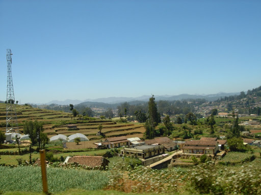 Request was granted, but not before stuffing ourselves with aalu and onion parotas! Once done, we took up a hotel room and hit the sack straight away. The two hour doze was really helpful. We started the next phase of mission after checking out around 12:30pm.
Request was granted, but not before stuffing ourselves with aalu and onion parotas! Once done, we took up a hotel room and hit the sack straight away. The two hour doze was really helpful. We started the next phase of mission after checking out around 12:30pm.Rendezvous with the Baap of all Bettas
As I took the pillion seat, I tried to make full use of it. The camera went clicking and clicking; a lot of good snaps would have come, but for the bad roads to end them all as shaky as ever :(.
Unlike the last time I’d driven down to Ooty and seen only fog and cloud at view-points, this was quite different. Clear blue skies and light hew greeted as we climbed further towards the tallest peak in a state sometimes known for fundamental linguistics, was christened in Kanadda – perhaps a true example of united On the way to Coonoor
As we descended the roads from Dodda Betta and took turn towards Coonoor, the sight was not exactly soothing to eyes, nor feelings welcomed by my bottom! The tar suddenly gave way to mud and slush; boulders filled up the rest, all together, pretty painful. Thankfully, this road
condition didn't last long and after a couple of kms, we found ourselves on good roads. As the road meandered down towards Coonoor, I was on constant look out for the Toy Train that I'd taken for this journey the last time that I was in this region. Though the whistle could be heard once, the train continued to elude me. It was only when we were nearing Aruvankadu, I realized my mistake - all the while I was trying to find the train down in the valley, while it was running parallel to us on the other side, about half a km up the valley slope. As we approached Aruvankadu, the tummy started roaring louder than the bike; it was time to stop.Saapadam @ Aruvankadu
The least we talk about the food, the better! It was one of the most ordinary chicken biryani that I ever had.
Add to that an 'extra helpful' man who was in a state of his own and a bit of bother!! All in all, a very forgettable experience :( It was time to turn back, and give Coonoor a miss for the time being - hoping that visiting this place would be an independent trip by itself.Climbing down Kalahatti Ghats
As we hit Ooty back on our way, it really helped to go back to our breakfast hotel and help ourselves with a cup of tea.
Also, there was boiled corn in offering on the other side of road. It was time that I took back the controls; not that Azmi could not drive down, it was the weight that needed to be handled while breaking on the way down hill. And some down hill it was - the engine roared in second gear almost all the time - breaks only being used intermittently to kill momentum. Still, the section was too good an experience to be missed. Azmi finally tried his hand after around three quarters of the ghats, and drove all the way till we hit the 'plains'.Parting Show
As we stopped over at Mudumalai for tea and snacks break, we came across this all excited man who spoke very fast Tamil. All I could recognize out of speech was 'yana'.
Azmi was a bit puzzled - he couldn't make head or tail of the lines spoken. "What is he talking about?" "He says that few elephants were sighted a few kms away." Probably the next thing both of us were thinking was only if we could get that lucky... (In my last dedicated trip to Bandipur, all I could find were deer, peacocks and wild buffalo) As we continued further, the gift (or rather gifts) was awaiting us - we came across 3 of them, and one was a tusker!Juicy Gundalpet
As our bottoms hit the rock (read road in between Bandipur and Gundalpet), the juice shop in Gundalpet was what we were really looking forward to. This was Azmi's discovery on his way to Calicut. It's opposite to the KSRTC bus stand, in the basement of hotel Udupi Uphar (IIRC). Boy, this place rocked! The Fresh Lime with Soda gave Anand's (near PESIT, Bangalore) some
competition :) The next proper stop came only beyond Maddur. Shivalli, a restaurant next to Cafe Coffee Day, did not live up to its hype - may be it was end of business for them, but I found wanting... Still it did give my eyes some relief from those dreaded sand laden trucks. It was around 11:30 by the time we were close to our places. Once at Azmi's place, it was time to pick my stuff and my bike back. In exactly 24 hours, I was preparing to hit the sack, happy and satisfied to break my 6 month 'break'. As I was to find out later, this gave way to the first ever solo trip that I made on my bike, more than 5 years since I took Pulsar to road, to Chennai...Sunday, August 05, 2007
2007-06-30: Wandering around Chikmangalur, the 'Malnad'
It started with an email conversation at 8:00PM
"Aaj raat thora midnight drive karne ka man kar raha hai..."
(I wish I could go on a midnight drive tonight...)
"Kahan?"
(Where?)
It was Azmi. This was followed by a call around 10PM.
"I was thinking if we can visit Nandi Hills tomorrow early morning, its been a while now..."
"Don't talk to me about midnight drive and Nandi Hills together. With due respect to Nandi Hills, being only 70 odd kilometers from Bangalore, its hardly a drive..."
"Then what about Yercaud, the poor man's Ooty?"
"Ok, can go there, but then again, it will hardly be a drive, though its about 240kms away, the road's probably too good and it will hardly take 5hrs. Also, in this rain, what about Chikmangalur, it will be ideal time to check out the definition Malnad?"
After a bit of persuasion, Azmi agreed, "Umm... Ok!"
The Start
I got another call from him around 11PM, "There's a twist in tale, one of my friends is also interested in joining us. He has sold his bike away, and now only has a car. Catch - the car does not have a jack (tool to replace any tyre). If we get it from anyone, we'll go by car, else on two of our bikes. What say?"
This time, it was I who had to be convinced to opt for car instead of car. Assuming it was nearly impossible to get hold of a jack at midnight I agreed; I didn't know that I was in for a surprise.
12:15AM, I got a call from a happy sounding Azmi, "Well, get ready for a car trip, we've managed a jack!" Around 12:40AM, I heard a car pulling up below my house, it was Azmi. "Where's the owner of the car?", I asked. I was kind of circumspect about the new person joining the trip, how would he be, high headed or a goof or uninteresting? "Hi, this is Vivek Jha.", he was a colleague of Azmi, working with Azul Systems. As time went by, I was happy to realize that I was in good company, with people having, what we call, matching frequency [:)]
We filled up the tank to the brim and were away by 1AM, minus, well, enough cash in pocket - an outcome of a collection of lazy bones, lazy enough not to go on the other side of road for an ATM until there were no more ATMs in sight!
The Night Drive
As Vivek drove us out of Bangalore, he looked kind of happy. When asked, he gave me a small information - he was driving a car for the first time on a highway! Well, let me tell you, though I sincerely felt that he was a bit crude, he was very safe and did not take any chances while on the wheel. Came Nelamangala and I took over. This was the first time that I was driving a Ford Ikon (though I had driven a Ford before - my Mustang while I was in Roseville [:)]). His Flair had pretty good pickup, but lacked in headlight beam alignment. The following rain didn't help the cause either; thankfully, there was not much until we crossed Hassan. Looking at the road map, we were supposed to take a right for Mudegiri, about 4kms after Sakleshpur. But the pelting rain saw to it that we didn't get much help from any of the parked trucks in Sakleshpur. We had to depend upon the Kannada knowledge that we had; I could somehow read few of the characters put on one of the sign boards on road side and decided to take a deviation.
"If you think thats the right way to go, go ahead. Worst case it'll not be the shortest way; we have anyway come out to roam the country.", and we all laughed out aloud. That's called company! Going ahead, however, we could make out that it was indeed the way to go. Though single lane, the road quality was way better than what we had got between Hassan and Sakleshpur. After confirming that it was OK for the driver, the two passengers went snoozing for the next hour or so.
Good Morning
The rain gods had not left us since little beyond Hassan, and the blessings continued. It was around 6AM and we had already crossed Mudigere that the passengers came back to activity.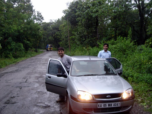 A little rain break gave us enough time to get freshed up. Broad day light meant that it was time for a switch on wheels. And so was the time to get hold of Azmi's camera. The scene outside was was just... true Malnad, meaning 'Region of Heavy Rainfall'. The greenery and rain all around was just majestic, we could see step farming, small cascades and what not. Opps, one thing was missing - a place for having tindi (Kannada word for breakfast).
Idli for Tindi with Hot Tea, and some shopping
Finally, we found a small hotel at a junction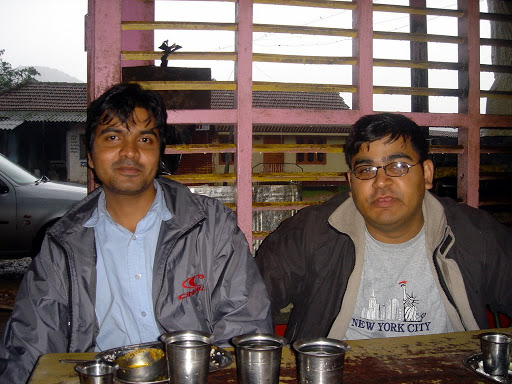 (can't remember the name). In fact, there were quite a few hotels to choose from. We finally chose the one that looked cleanest of all. Warm Idli with Chutni and Sambhar was the need of hour and thats what we precisely got. Though not the best I've ever had, the platter came as a true blessing.
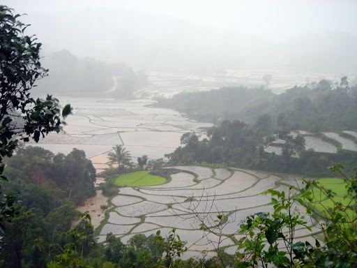 Once done with breakfast, the next thing in mind was to get some protective gear against rain. We had already taken notes by observing the locals there and we wasted no time to adapt ourselves to the culture. We needed to take a right at this place; going straight would have led us to Dharmasthala through Charmadi Ghats.
The Overflowing River
Revitalized, we headed towards the first of our listed 'nice to see' places - Hornadu. As we crossed Kalasa, we stopped to ask for direction, and were informed that the road ahead was blcoked; the Tunga river was overflowing, engulfing the bridge 4kms before Hornadu. Not exactly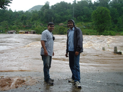 the most encouraging news, never the less, none of us had seen actual flooding in South India. We continued ahead to get a glimpse of the 'invisible' bridge. We were indeed greeted with one, with Kudremukh range in the background. We went out in the rain like kinder garden kids, enthused to empty the camera's memory card with our snaps. "Look where I went, that's a bridge behind me, you know, it got submerged in the river..!" Our next destination was Kudremukh, and possibly the Hanumana Gundi Waterfalls.
Towards Kudremukh
We came back to Kalasa, and took a right turn on the road leading to Kudremukh. As we negotiated few corners, there was some pleasant surprise waiting for us. Amidst the coffee country, we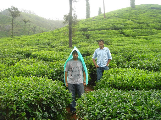 were suddenly meandering through tea estates. We couldn't help but stopped there and just dashed into the plantation. It was not easy to drag ourselves out but then somehow we did it!
There was more rain to follow us, more in terms of its fury than beauty.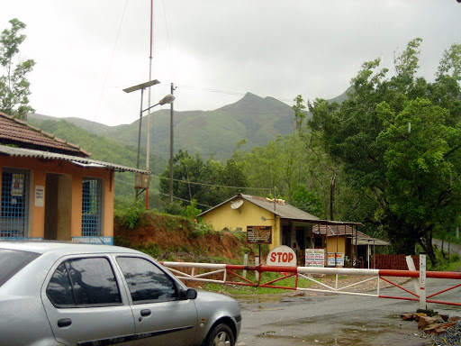 As we approached the Kudremukh National Park check-post, we could see it closed. Upon inquiry, we found out that there was a landslide a couple of kilometers further and the road was non-motorable. Kudremukh was as far as 14kms! After coming back to Kalasa, we spent some time on deciding upon the next destination. We found out that the alternate route to Kudremukh was also blocked. It was going to be Kemmangundi, coming back to Mudigere and going beyond Chikmangalur town towards Baba Budhan Range.
Coming Back to Mudigere for Some Oota
There was another factor that we needed to take into consideration, we were short on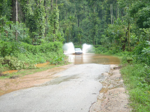 fuel and we were short of cash. Not making it to Kudremukh meant that ATMs were still out of range. We decided to get fuel for the car and postpone our own refill till we reached Chikmangalur. There were few water pools that we had negotiated while going towards Kalasa. Now was the time to encash. The car went forward, dropped me and then backed off. It was time for a splash!
Once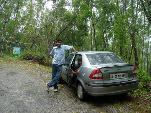 back inside car, it was time that I finally took the back seat, for some well deserved rest. It was however Azmi who had been driving for most of the time since morning. Once we reached Mudigere, we were in for some more pleasantries. This place was big enough to have ATMs and doable hotels for oota (luncheon) . In morning, we had actually bypassed the town while heading towards Kalasa from Sakleshpur; the way to Chikmangalur was through Mudigere town.
On the Way to Kemmangundi
The journey from Mudigere to Chikmangalur town was rather uneventful.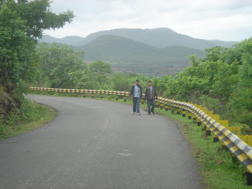 We stopped over in the district HQ to get some chips and all essential potable water bottles. From this place, there were a couple of ways that we could have gone to Kemmangundi - via Baba Budhan Range (which passes in proximity to Mullayangiri (Karnataka's tallest peak) and Bababudhangiri), and the other being the highway to Tarikere
  (on Tumkur-Honnavar NH). The scenery was captive enough to make us miss the former route, something that we didn't bother about. This was the first time in the day that rain had stopped and we had some fairly clear sky. It was time to get out of the confines of car and wander around, sit on the road and get into the woods. We spent some time there before the rain gods caught up with us.
Kalahasti Falls
Kalahasti Falls is about 10kms before Kemmangundi, and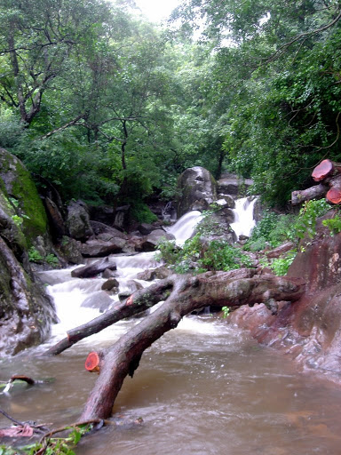 offers some very safe bathing zone if one's interested in having some fun. It also hosts around five century old temple at the base of the falls. As we reached it, we could have got all wet without going into the falls, and no, it wasn't that spray typical to water falls. If you still can't get it, it was well, our good old companion,
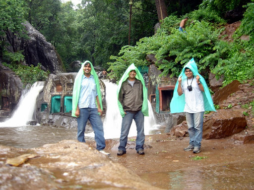 the rain [:D]. Time was again to take out protective gear that we bought in the morning. All the 10 bucks spent on that was put to proper use. It was nothing but a big sheet made out of recycled green colored plastic. Well, mine was blue in color, to be precise. This was one souvenir that we got back from this trip! We felt like those firangs; being given wierd looks by the passers by and the tourists alike. It was a different story that we were not complaining; we were rather enjoying that!
Enter Kemmangundi
It was past 6PM that we entered Kemmangundi. This scenic hill-station, 55 km north of Chikmangalur, is situated on the Baba Budhan range at a height of 1,434 m. Not the best of the times to be there if you are looking forward to some breath taking views, coz everything was painted white and grey - the color of clouds.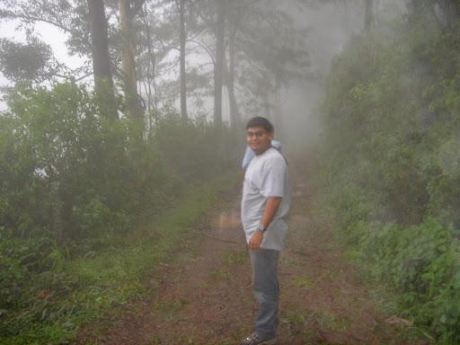 Positioned 8 km from Kemmangundi are the Hebbe Falls, where we could not go as it was getting a bit too dark. The original plan was to try finding an overnight shelter at the Horticulture Department's Inspection Bungalow. This plan was however disturbed by the presence of leeches, and too many of them. They were just everywhere, from steering wheel of car to our jeans, trying to get in through the tough fabric and guess what, succeeding in the feat! Azmi had to literally tear off one of them as it had taken position to make him weigh less by few grams of blood.
"Lets get out of here!"
"We have another situation, one of the back tyres seem to be flat!"
Way Back - the Jack comes to rescue
I checked out the spare one lying in the boot space and i could feel my palm sinking a long way in.
"It doesn't seem to hold enough air."
"Then lets get to the nearest puncture repair shop as quickly as possible."
I took over the wheels. Driving fast was out of question, with not so good roads and considerable mist. A couple of kilometers down and I realized that continuing any further on the flat tyre could have spelt doom on its life. We pulled over and then followed a perfect example of team work - Azmi got busy with the jack while I took care of taking out bolts off. Vivek was mercurial at showing us the 'mobile torch' and keeping the spare tyre out ready for replacement. We were off within 15minutes amidst total darkness and light drizzle! Once we reached plain lands, we luckily found a very good puncture repair shop. Irony remains that the spare tyre actually had just the right air pressure; it would make me think twice when I check for it the next time for any tyre by merely pressing it! Another irony, adjusting the headlight focus took more time and money though it was not done to 100% satisfaction. A Dosa dinner at Kaddur (again on Tumkur-Honnavar NH) and someone asked me, "What time are we expecting to get back?" "Around 3AM." "Ok, don't think you are going to mind if we sleep, will you?" "Feel Free!"
With a break in between, we reached the toll-gate for the completed sector of NH-4, in between Tumkur and Nelamangala. I offered the wheel to Vivek, and he was more than happy to take over! By the time Vivek dropped Azmi and then me at my doorsteps, it was around 2:30AM, still about 30 minutes ahead of expected schedule, thanks to no rain after Kaddur.
A little less than 800kms were done in a little over 25 hours. Selected moments of the trip can be found here. This was kind of a second such trip for me; had been to Coorg for the third time, this time with Arnab, a round trip of around 680kms in less than 23 hours of biking. I was not aware that the next trip following this one to Chikmangalur would again fall in same category - ~650kms done for a glimpse of Iruppu Falls in 16 hours with Abdulla.
"Aaj raat thora midnight drive karne ka man kar raha hai..."
(I wish I could go on a midnight drive tonight...)
"Kahan?"
(Where?)
It was Azmi. This was followed by a call around 10PM.
"I was thinking if we can visit Nandi Hills tomorrow early morning, its been a while now..."
"Don't talk to me about midnight drive and Nandi Hills together. With due respect to Nandi Hills, being only 70 odd kilometers from Bangalore, its hardly a drive..."
"Then what about Yercaud, the poor man's Ooty?"
"Ok, can go there, but then again, it will hardly be a drive, though its about 240kms away, the road's probably too good and it will hardly take 5hrs. Also, in this rain, what about Chikmangalur, it will be ideal time to check out the definition Malnad?"
After a bit of persuasion, Azmi agreed, "Umm... Ok!"
The Start
I got another call from him around 11PM, "There's a twist in tale, one of my friends is also interested in joining us. He has sold his bike away, and now only has a car. Catch - the car does not have a jack (tool to replace any tyre). If we get it from anyone, we'll go by car, else on two of our bikes. What say?"
This time, it was I who had to be convinced to opt for car instead of car. Assuming it was nearly impossible to get hold of a jack at midnight I agreed; I didn't know that I was in for a surprise.
12:15AM, I got a call from a happy sounding Azmi, "Well, get ready for a car trip, we've managed a jack!" Around 12:40AM, I heard a car pulling up below my house, it was Azmi. "Where's the owner of the car?", I asked. I was kind of circumspect about the new person joining the trip, how would he be, high headed or a goof or uninteresting? "Hi, this is Vivek Jha.", he was a colleague of Azmi, working with Azul Systems. As time went by, I was happy to realize that I was in good company, with people having, what we call, matching frequency [:)]
We filled up the tank to the brim and were away by 1AM, minus, well, enough cash in pocket - an outcome of a collection of lazy bones, lazy enough not to go on the other side of road for an ATM until there were no more ATMs in sight!
The Night Drive
As Vivek drove us out of Bangalore, he looked kind of happy. When asked, he gave me a small information - he was driving a car for the first time on a highway! Well, let me tell you, though I sincerely felt that he was a bit crude, he was very safe and did not take any chances while on the wheel. Came Nelamangala and I took over. This was the first time that I was driving a Ford Ikon (though I had driven a Ford before - my Mustang while I was in Roseville [:)]). His Flair had pretty good pickup, but lacked in headlight beam alignment.
The following rain didn't help the cause either; thankfully, there was not much until we crossed Hassan. Looking at the road map, we were supposed to take a right for Mudegiri, about 4kms after Sakleshpur. But the pelting rain saw to it that we didn't get much help from any of the parked trucks in Sakleshpur. We had to depend upon the Kannada knowledge that we had; I could somehow read few of the characters put on one of the sign boards on road side and decided to take a deviation."If you think thats the right way to go, go ahead. Worst case it'll not be the shortest way; we have anyway come out to roam the country.", and we all laughed out aloud. That's called company! Going ahead, however, we could make out that it was indeed the way to go. Though single lane, the road quality was way better than what we had got between Hassan and Sakleshpur. After confirming that it was OK for the driver, the two passengers went snoozing for the next hour or so.
Good Morning
The rain gods had not left us since little beyond Hassan, and the blessings continued. It was around 6AM and we had already crossed Mudigere that the passengers came back to activity.
A little rain break gave us enough time to get freshed up. Broad day light meant that it was time for a switch on wheels. And so was the time to get hold of Azmi's camera. The scene outside was was just... true Malnad, meaning 'Region of Heavy Rainfall'. The greenery and rain all around was just majestic, we could see step farming, small cascades and what not. Opps, one thing was missing - a place for having tindi (Kannada word for breakfast).Idli for Tindi with Hot Tea, and some shopping
Finally, we found a small hotel at a junction
(can't remember the name). In fact, there were quite a few hotels to choose from. We finally chose the one that looked cleanest of all. Warm Idli with Chutni and Sambhar was the need of hour and thats what we precisely got. Though not the best I've ever had, the platter came as a true blessing. Once done with breakfast, the next thing in mind was to get some protective gear against rain. We had already taken notes by observing the locals there and we wasted no time to adapt ourselves to the culture. We needed to take a right at this place; going straight would have led us to Dharmasthala through Charmadi Ghats.The Overflowing River
Revitalized, we headed towards the first of our listed 'nice to see' places - Hornadu. As we crossed Kalasa, we stopped to ask for direction, and were informed that the road ahead was blcoked; the Tunga river was overflowing, engulfing the bridge 4kms before Hornadu. Not exactly
the most encouraging news, never the less, none of us had seen actual flooding in South India. We continued ahead to get a glimpse of the 'invisible' bridge. We were indeed greeted with one, with Kudremukh range in the background. We went out in the rain like kinder garden kids, enthused to empty the camera's memory card with our snaps. "Look where I went, that's a bridge behind me, you know, it got submerged in the river..!" Our next destination was Kudremukh, and possibly the Hanumana Gundi Waterfalls.Towards Kudremukh
We came back to Kalasa, and took a right turn on the road leading to Kudremukh. As we negotiated few corners, there was some pleasant surprise waiting for us. Amidst the coffee country, we
were suddenly meandering through tea estates. We couldn't help but stopped there and just dashed into the plantation. It was not easy to drag ourselves out but then somehow we did it!There was more rain to follow us, more in terms of its fury than beauty.
As we approached the Kudremukh National Park check-post, we could see it closed. Upon inquiry, we found out that there was a landslide a couple of kilometers further and the road was non-motorable. Kudremukh was as far as 14kms! After coming back to Kalasa, we spent some time on deciding upon the next destination. We found out that the alternate route to Kudremukh was also blocked. It was going to be Kemmangundi, coming back to Mudigere and going beyond Chikmangalur town towards Baba Budhan Range.Coming Back to Mudigere for Some Oota
There was another factor that we needed to take into consideration, we were short on
fuel and we were short of cash. Not making it to Kudremukh meant that ATMs were still out of range. We decided to get fuel for the car and postpone our own refill till we reached Chikmangalur. There were few water pools that we had negotiated while going towards Kalasa. Now was the time to encash. The car went forward, dropped me and then backed off. It was time for a splash!Once
back inside car, it was time that I finally took the back seat, for some well deserved rest. It was however Azmi who had been driving for most of the time since morning. Once we reached Mudigere, we were in for some more pleasantries. This place was big enough to have ATMs and doable hotels for oota (luncheon) . In morning, we had actually bypassed the town while heading towards Kalasa from Sakleshpur; the way to Chikmangalur was through Mudigere town.On the Way to Kemmangundi
The journey from Mudigere to Chikmangalur town was rather uneventful.
We stopped over in the district HQ to get some chips and all essential potable water bottles. From this place, there were a couple of ways that we could have gone to Kemmangundi - via Baba Budhan Range (which passes in proximity to Mullayangiri (Karnataka's tallest peak) and Bababudhangiri), and the other being the highway to Tarikere (on Tumkur-Honnavar NH). The scenery was captive enough to make us miss the former route, something that we didn't bother about. This was the first time in the day that rain had stopped and we had some fairly clear sky. It was time to get out of the confines of car and wander around, sit on the road and get into the woods. We spent some time there before the rain gods caught up with us.Kalahasti Falls
Kalahasti Falls is about 10kms before Kemmangundi, and
offers some very safe bathing zone if one's interested in having some fun. It also hosts around five century old temple at the base of the falls. As we reached it, we could have got all wet without going into the falls, and no, it wasn't that spray typical to water falls. If you still can't get it, it was well, our good old companion, the rain [:D]. Time was again to take out protective gear that we bought in the morning. All the 10 bucks spent on that was put to proper use. It was nothing but a big sheet made out of recycled green colored plastic. Well, mine was blue in color, to be precise. This was one souvenir that we got back from this trip! We felt like those firangs; being given wierd looks by the passers by and the tourists alike. It was a different story that we were not complaining; we were rather enjoying that!Enter Kemmangundi
It was past 6PM that we entered Kemmangundi. This scenic hill-station, 55 km north of Chikmangalur, is situated on the Baba Budhan range at a height of 1,434 m. Not the best of the times to be there if you are looking forward to some breath taking views, coz everything was painted white and grey - the color of clouds.
Positioned 8 km from Kemmangundi are the Hebbe Falls, where we could not go as it was getting a bit too dark. The original plan was to try finding an overnight shelter at the Horticulture Department's Inspection Bungalow. This plan was however disturbed by the presence of leeches, and too many of them. They were just everywhere, from steering wheel of car to our jeans, trying to get in through the tough fabric and guess what, succeeding in the feat! Azmi had to literally tear off one of them as it had taken position to make him weigh less by few grams of blood."Lets get out of here!"
"We have another situation, one of the back tyres seem to be flat!"
Way Back - the Jack comes to rescue
I checked out the spare one lying in the boot space and i could feel my palm sinking a long way in.
"It doesn't seem to hold enough air."
"Then lets get to the nearest puncture repair shop as quickly as possible."
I took over the wheels. Driving fast was out of question, with not so good roads and considerable mist. A couple of kilometers down and I realized that continuing any further on the flat tyre could have spelt doom on its life. We pulled over and then followed a perfect example of team work - Azmi got busy with the jack while I took care of taking out bolts off. Vivek was mercurial at showing us the 'mobile torch' and keeping the spare tyre out ready for replacement. We were off within 15minutes amidst total darkness and light drizzle! Once we reached plain lands, we luckily found a very good puncture repair shop. Irony remains that the spare tyre actually had just the right air pressure; it would make me think twice when I check for it the next time for any tyre by merely pressing it! Another irony, adjusting the headlight focus took more time and money though it was not done to 100% satisfaction. A Dosa dinner at Kaddur (again on Tumkur-Honnavar NH) and someone asked me, "What time are we expecting to get back?" "Around 3AM." "Ok, don't think you are going to mind if we sleep, will you?" "Feel Free!"
With a break in between, we reached the toll-gate for the completed sector of NH-4, in between Tumkur and Nelamangala. I offered the wheel to Vivek, and he was more than happy to take over! By the time Vivek dropped Azmi and then me at my doorsteps, it was around 2:30AM, still about 30 minutes ahead of expected schedule, thanks to no rain after Kaddur.
A little less than 800kms were done in a little over 25 hours. Selected moments of the trip can be found here. This was kind of a second such trip for me; had been to Coorg for the third time, this time with Arnab, a round trip of around 680kms in less than 23 hours of biking. I was not aware that the next trip following this one to Chikmangalur would again fall in same category - ~650kms done for a glimpse of Iruppu Falls in 16 hours with Abdulla.
Subscribe to:
Posts (Atom)